
C-MAP
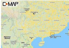
C-MAP M-AN-Y300-MS Hong Kong to Macau MAX-N+ Chart
C-MAP M-AN-Y300-MS Hong Kong to Macau MAX-N+ Chart
Low stock: 1 left
Couldn't load pickup availability
C-MAP MAX-N+ Hong Kong to Macau Local Marine Chart (M-AN-Y300-MS)
The C-MAP M-AN-Y300-MS is a high-precision local electronic marine navigation chart engineered specifically for the dense, high-traffic coastal waters surrounding Hong Kong, Macau, and the Pearl River Delta. Built on C-MAP’s advanced MAX-N+ cartography platform, it delivers rich vector chart data tailored for compatible Simrad, Lowrance, and B&G multi-function displays (MFDs).
This local chart package equips commercial vessel operators, recreational cruisers, and sport fishermen with critical navigation detail—including high-resolution bathymetric contours, dynamic raster chart views, detailed marina port plans, channel buoy markers, and shallow-water hazard alerts across the Pearl River Estuary.
Key Features
-
Comprehensive Local Coverage: Detailed nautical mapping spanning Hong Kong Victoria Harbour, Lamma Island, Lantau Island, Macau, and adjacent Pearl River Delta coastal channels.
-
Full-Featured Vector Charts: Delivers rich depth soundings, channel aids to navigation (AtoNs), anchorage boundaries, and restricted maritime zones.
-
High-Resolution Bathymetry (HRB): Ultra-dense contour layer highlighting underwater trenches, reefs, and drop-offs for tactical angling and safe shallow-draft navigating.
-
Custom Depth Shading: Allows boaters to set custom safety depths and color-code depth ranges for easy visual identification of shallow waters.
-
C-MAP Easy Routing: Automatically plots the shortest, safest route based on detailed chart data and user-entered vessel draft/beam dimensions.
-
Tides & Currents Integration: Real-time tide height predictions and dynamic current flow overlays for navigating tidal channels.
Share