
OBMG Online
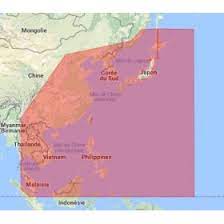
C-MAP M-AN-D050 Asia North Continental Marine Chart
C-MAP M-AN-D050 Asia North Continental Marine Chart
Low stock: 2 left
Couldn't load pickup availability
C-MAP Asia North Continental Marine Cartography (M-AN-D050-MS / M-AN-D050)
The C-MAP M-AN-D050 (ordering part number M-AN-D050-MS) is a high-resolution electronic marine chart covering the coastal and continental waterways of Asia North. Built on C-MAP’s advanced 4D MAX+ mapping architecture, it provides detailed vector chart data, dynamic raster overlay options, high-resolution bathymetric contours, 3D land and bottom views, and satellite imagery for marine chartplotters and multi-function displays (MFDs).
The card delivers comprehensive navigation data—including harbor profiles, marina details, tides, currents, and automated route planning—making it an essential navigation asset for commercial vessels, coastal cruisers, and offshore anglers operating across East and North Asian waters.
Key Features
-
Full-Featured Vector Charts: Comprehensive depth contours, nav-aids, spot soundings, obstruction data, and buoy characteristics.
-
High-Resolution Bathymetry (HRB): Ultra-dense contour layer highlighting underwater drop-offs, ledges, pinnacles, and canyons for tactical angling and coastal navigation.
-
Dynamic Raster Overlay: Provides a traditional "paper chart" aesthetic with interactive, clickable navigation objects.
-
3D Terrain & Bottom Views: Three-dimensional perspective views of land elevation and seabed topography.
-
High-Resolution Satellite Imagery: Overhead photo coverage for enhanced situational awareness when approaching unknown harbors or channels.
-
Easy Routing & Tidal Data: Automatically calculates optimal routes based on draft/vessel dimensions and provides real-time tide/current predictions.
Share